
What are the key facts about Utah?
Utah is a western U.S. state that joined the Union on January 4, 1896, as the 45th state. Its capital and largest city is Salt Lake City. Utah is known for five national parks, the Great Salt Lake, and red-rock desert landscapes in the south, including the St. George area.
We checked every fact on this page against the source named next to it, mostly the U.S. Census Bureau, the Utah Code, the National Park Service, the U.S. Geological Survey and the Utah Division of State History. Where sources disagree, we say so. The Southern Utah section draws on our own St. George guides.
What are some fun facts about Utah?
Some fun facts about Utah: the transcontinental railroad was finished at Promontory Summit in 1869, Seraph Young cast the first vote by a woman in the United States in Salt Lake City in 1870, the Utahraptor is the state dinosaur, the Dutch oven is the state cooking pot, and St. George has dinosaur tracks found in 2000.
- Golden Spike: the Central Pacific and Union Pacific railroads met at Promontory Summit on May 10, 1869 (National Park Service).
- First woman voter: Seraph Young voted in Salt Lake City in February 1870 (Utah Division of State History).
- Odd state symbols: Utah has an official state cooking pot (the Dutch oven), crustacean (brine shrimp) and work of land art (Spiral Jetty), all set in Utah Code 63G-1-601.
- Dinosaur tracks in town: the St. George Dinosaur Discovery Site at Johnson Farm was built over tracks found in February 2000 (Utah Geological Survey).
- Desert low point: Utah's lowest spot, Beaver Dam Wash, is in Washington County, near St. George, at about 2,000 feet.
Each fact is explained, with its source, further down this page.
Utah quick facts
| Fact | Answer | Source |
|---|---|---|
| Capital | Salt Lake City | Utah.gov |
| Largest city | Salt Lake City | U.S. Census Bureau city estimates |
| Statehood | January 4, 1896 (45th state) | Utah Division of State History |
| Population | 3,538,904 (estimate for July 1, 2025) | U.S. Census Bureau, Vintage 2025 |
| Total area | 84,897 square miles, 13th largest state | U.S. Census Bureau |
| Counties | 29 | Utah.gov |
| Nickname | The Beehive State | Utah.gov |
| State motto | Industry | Utah Code 63G-1-601 |
| What residents are called | Utahns | Utah Code 63G-1-601 |
| Highest point | Kings Peak, 13,528 feet | U.S. Geological Survey |
| Lowest point | Beaver Dam Wash, about 2,000 feet | U.S. Geological Survey |
| Average elevation | About 6,100 feet | U.S. Geological Survey |
How did Utah get its name?
Utah is named after the Ute people, an American Indian tribe, according to Utah.gov. The state's quick-facts page also records a second account, that the name comes from an Apache word, so historians don't fully agree on what the original word meant.
When did Utah become a state?
Utah became the 45th state on January 4, 1896, according to the Utah Division of State History. Two earlier milestones also happened in Utah:
- The transcontinental railroad was finished in Utah. The Central Pacific and Union Pacific met at Promontory Summit on May 10, 1869, where the last spike was driven. It is now Golden Spike National Historical Park, run by the National Park Service.
- A Utah woman cast an early vote under a women's suffrage law. The Utah Division of State History says Seraph Young was the first woman in the United States to cast a vote, in a Salt Lake City election in February 1870, the same month Utah's territorial legislature gave women the vote.
What are Utah's five national parks?
Utah has five national parks: Zion, Bryce Canyon, Arches, Capitol Reef and Canyonlands. Zion was the first to become a national park, in 1919, and it is by far the busiest, with 4,946,592 recreation visits in 2024, according to the National Park Service. Two of the five, Zion and Bryce Canyon, are within about two hours of St. George.
| Park | National park since | Recreation visits, 2024 | Drive from St. George |
|---|---|---|---|
| Zion National Park | 1919 | 4,946,592 | 42 miles, about 45 minutes |
| Bryce Canyon National Park | 1928 | 2,498,075 | 125 miles, about 2 hours |
| Arches National Park | 1971 | 1,466,528 | 310 miles, about 4 hours 30 minutes |
| Capitol Reef National Park | 1971 | 1,422,490 | 195 miles, about 3 hours 15 minutes |
| Canyonlands National Park | 1964 | 818,492 | 310 miles, about 4 hours 30 minutes |
Sources: National Park Service park history pages and the NPS Statistical Abstract 2024. Drive distances and times are from our own St. George drive guides.
What is the highest and lowest point in Utah?
Utah's highest point is Kings Peak in the Uinta Mountains, at 13,528 feet. The lowest point is Beaver Dam Wash, at about 2,000 feet, in the far southwest corner of the state in Washington County, the same county as St. George. Utah's average elevation is about 6,100 feet, according to the U.S. Geological Survey.
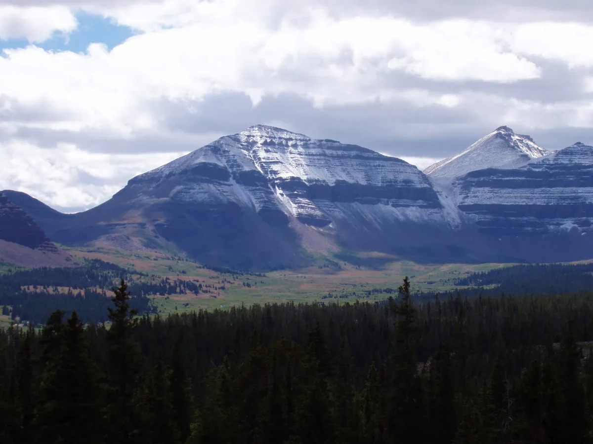
Our Utah elevation guide has the full table of high and low points and how high Southern Utah towns sit.
What are Utah's state symbols?
Utah's state symbols are set by law in Utah Code section 63G-1-601. The beehive is the state emblem, which is where the nickname “Beehive State” comes from, and the state motto is “Industry.” The law lists more than 40 symbols in all; here are 28 of them, in the statute's own wording.
| Symbol | Utah's official choice |
|---|---|
| State emblem | Beehive |
| State animal | Elk |
| State bird | Sea gull |
| State bird of prey | Golden eagle |
| State flower | Sego lily |
| State tree | Quaking aspen |
| State fish | Bonneville cutthroat trout |
| State insect | Honeybee |
| State reptile | Gila monster |
| State crustacean | Brine shrimp |
| State dinosaur | Utahraptor |
| State fossil | Allosaurus |
| State gem | Topaz |
| State mineral | Copper |
| State rock | Coal |
| State fruit | Cherry |
| State vegetable | Spanish sweet onion |
| State historic vegetable | Sugar beet |
| State grass | Indian rice grass |
| State mushroom | Porcini |
| State cooking pot | Dutch oven |
| State folk dance | Square dance |
| State firearm | John M. Browning-designed M1911 automatic pistol |
| State winter sports | Skiing and snowboarding |
| State work of land art | Spiral Jetty |
| State centennial star | Dubhe |
| State song | "Utah, This is the Place" |
| State hymn | "Utah We Love Thee" |
Source: Utah Code 63G-1-601, version effective May 7, 2025. Jell-O is often called Utah's state snack, but it was named by a 2001 Senate resolution, not by this law, so it isn't in the table.
What makes St. George and Southern Utah different?
St. George sits in Utah's southwest corner, at the edge of the Mojave Desert, and it is one of the lowest and warmest places in the state. These are the Southern Utah facts we get asked about most.
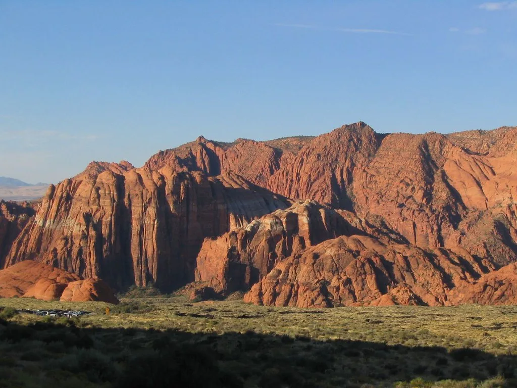
- St. George was founded as a cotton mission. Settlers were called to the area in 1861 to grow cotton, and many came from the American South, which is how the region got the nickname “Utah's Dixie,” according to the Utah Division of State History.
- It sits low for Utah. Downtown St. George is about 2,700 feet above sea level, less than half of Utah's average elevation. Our St. George elevation guide compares it with 25 nearby towns and landmarks.
- Utah's lowest point is in the same county. Beaver Dam Wash, at about 2,000 feet, is in Washington County, west of St. George.
- Zion is the closest national park. Zion National Park is about 42 miles and 45 minutes from St. George, and in 2024 it drew more visits than any other national park in Utah.
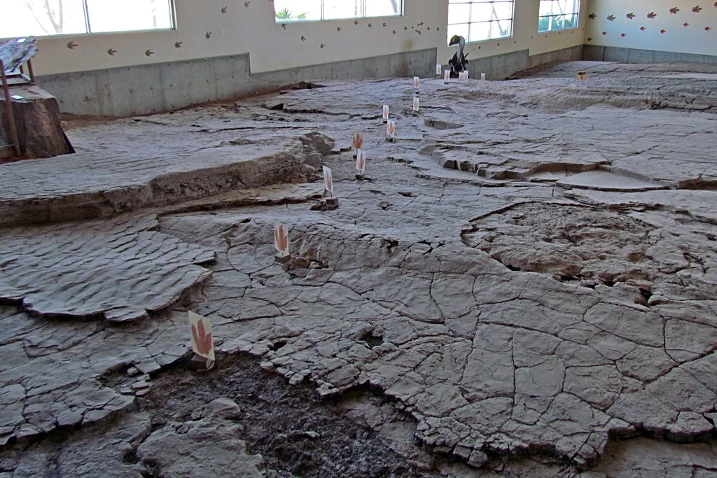
- Dinosaurs walked here. In February 2000, Sheldon Johnson uncovered fossil dinosaur tracks while leveling land on his property in St. George, according to the Utah Geological Survey. The site is now the St. George Dinosaur Discovery Site at Johnson Farm, a museum built over the tracks.
Land, water and wildlife
- Great Salt Lake: the U.S. Geological Survey calls it the largest saltwater lake in the Western Hemisphere. Brine shrimp are Utah's official state crustacean.
- Size: Utah covers 84,897 square miles, of which 82,170 are land, according to the Census Bureau, making it the 13th largest state by total area.
- Mountains to desert: elevations run from about 2,000 feet at Beaver Dam Wash to 13,528 feet at Kings Peak, a range of more than 11,000 feet.
- Average elevation: at about 6,100 feet, Utah has the third-highest average elevation of any state, after Colorado and Wyoming, according to the U.S. Geological Survey.
- Geographic center: the USGS places the geographic center of Utah in Sanpete County, 3 miles north of Manti.
- Land art: Spiral Jetty is Utah's official state work of land art.
- Winter sports by law: skiing and snowboarding are Utah's official state winter sports. The closest ski area to St. George is Brian Head; see our St. George to Brian Head drive guide.